Documento

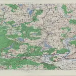
Sheet Angermunde (AMS M641), Central Europe
Scale: 1:100000; Relief Symbology: contours, gradient and bathymetric tints; Map Type: Topographic maps; Other Descriptive Notes about Map Series: Set includes various issues of some sheets, some reissued by U.S. Army Map Service (A. M. S. M641) and some by units of Allied Forces. This set and the set: Germany 1:100,000 (A. M. S. M641) which is separately cataloged, constitute a set complete in 134 sheets, some oversize. Military grid. Contour interval 25 metres above 50 meters, 10 metres below 50 metres. Some sheets also have altitude tints. Six classes of roads and paths, three classes of railroads, and wooded, vineyard and orchard areas are shown. Vegetation is not shown on ... sheet[s of] AFHQ layered edition. Compilation of a map of Central Europe on the scale of 1:100,000, undertaken by the British General Staff Geographical Section, was transferred to the U.S. Army Map Service, which published sheets in three series: Germany 1:100,000 (A. M. S. M641) and Poland 1:100,000 (A. M. S. M651) and Middle Danube 1:100,000 (A. M. S. M671) These all carry series note G. S. G. S. 4416, but each is cataloged separately. Each sheet includes Glossary. Marginal maps: Index to adjoining sheets and incidence of grid letters [and] G. S. G. S. 4346, Germany 1:250,000.--Compilation diagram. Index map is cataloged with Germany 1:100,00 (A. M. S. M641); superseded editions are classified with this set.
OldMapsOnline CommunityUnited States. Army Map Service.
1943
1943
United States. Army Map Service.
1:100 000

